The Challenge
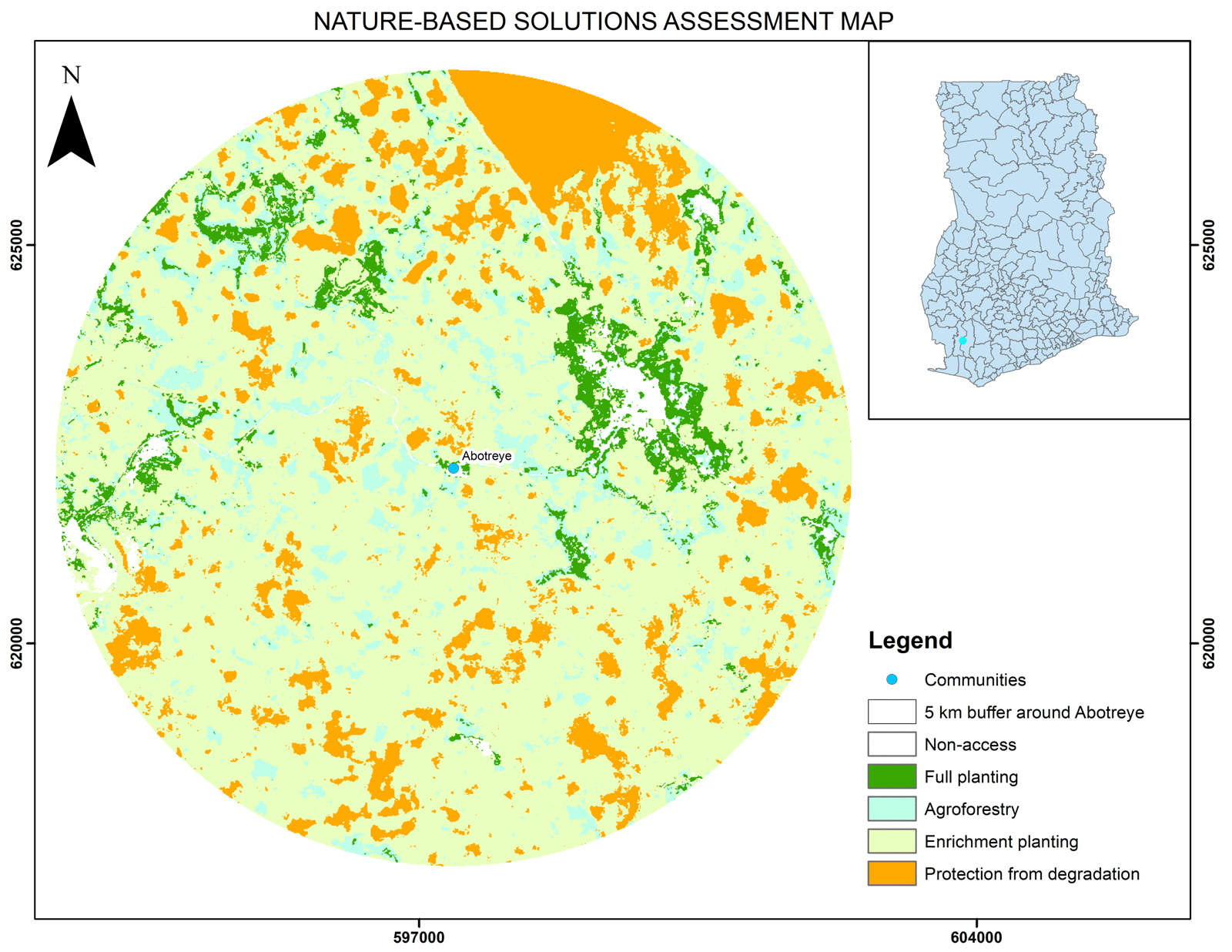
These Ghanaian landscapes faced ecological degradation caused by deforestation, farming expansion, and built-up pressure. The objective was to identify priority zones for forest restoration and balance ecological needs with community livelihoods.
Our Approach
We combined GIS spatial analysis and Analytical Hierarchy Process (AHP) to prioritize zones for:
Protection from degradation (existing forests)
Enrichment planting (medium canopy zones)
Full planting (bare and degraded land)
Key Data Inputs:
Land cover classification (trees, crops, built areas, water)
Canopy height maps (0–1m, 2–5m, 6–25m, 26+m)
How it was done:
Created 5km buffers around Lake Bosomtwe, Abotreye & Kamaso
Classified land cover & canopy height using remote sensing
Weighted criteria (Canopy Height 75%, Land Cover 25%) for decision-making
Generated restoration priority maps
Impact
Delivered high-resolution restoration maps for planning
Guided community-inclusive interventions
Supported Ghana’s Bonn Challenge & AFR100 commitments
Improved alignment with Nature-Based Solutions (NbS) for climate adaptation
Related Projects
Let us help you


