
The Climate & Risk Challenge
Communities, businesses, and governments face increasing risks from floods, wildfires, pollution, and climate change. Without proper spatial analysis, interventions are reactive instead of preventive – leading to higher costs and human impacts.
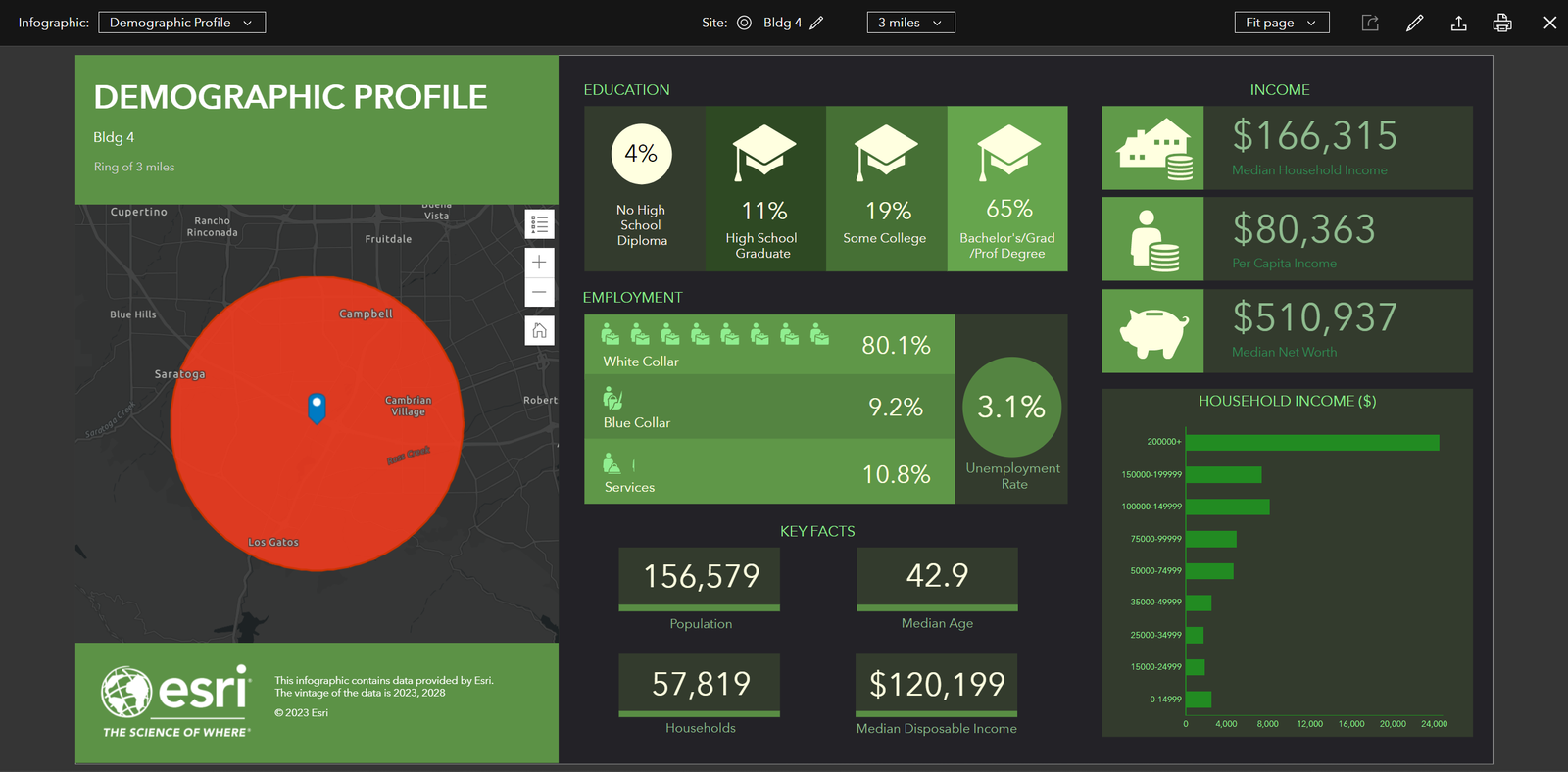
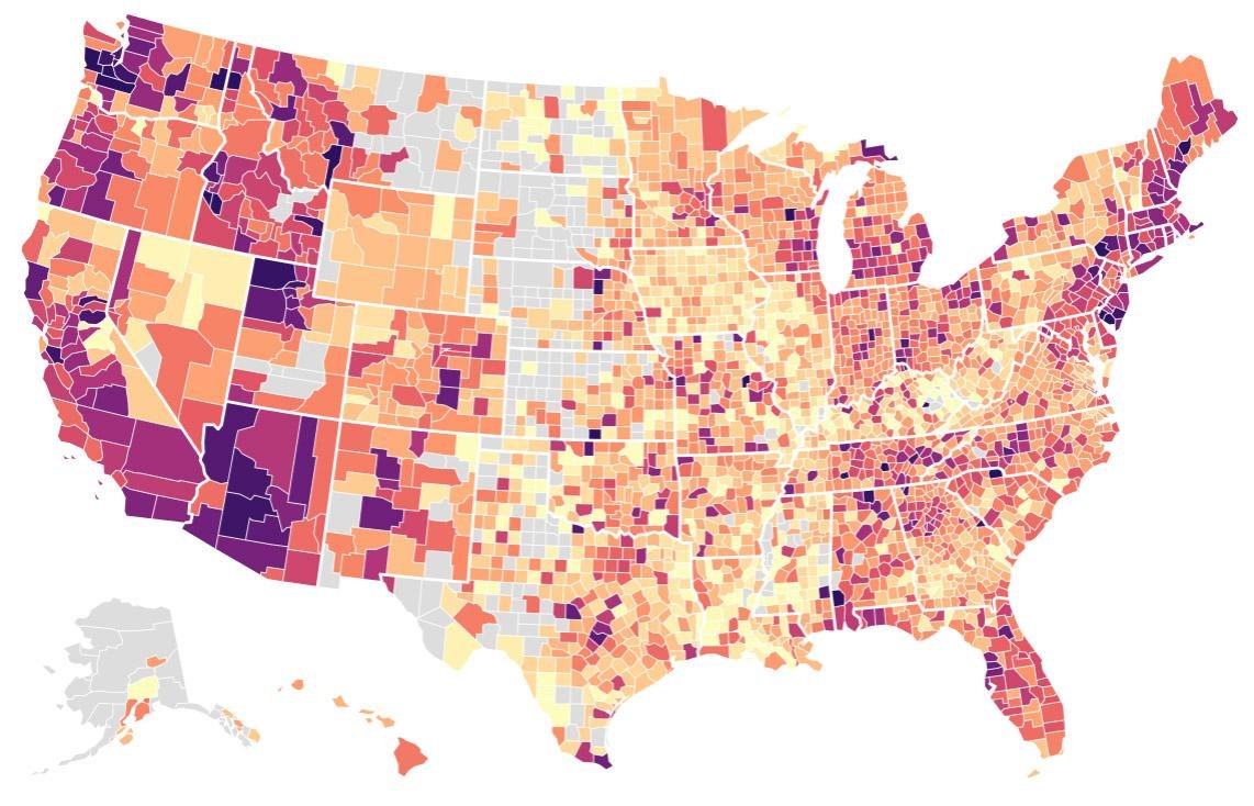
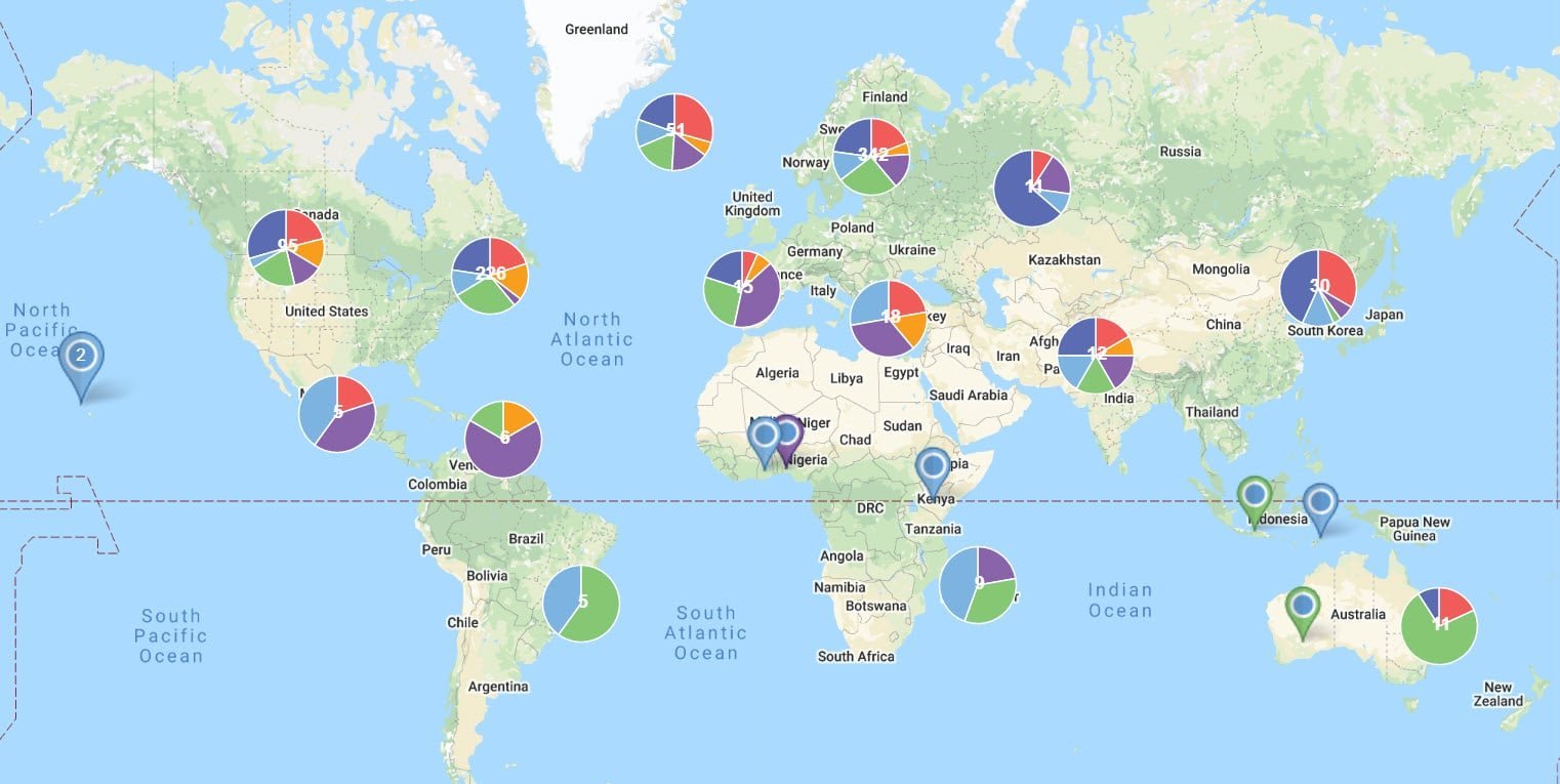
How ZoeSpatial Helps Map & Mitigate Risks

Hazard & Vulnerability Mapping

Resilience & Adaptation Planning

Real-Time Monitoring & Dashboards
Use Cases
Governments & City Planners
Disaster preparedness & zoning.
NGOs & Aid Agencies
Climate resilience interventions.
Insurance & Finance
Risk-based underwriting and investments.
Real Estate & Infrastructure
Safe, climate-resilient site planning.


Let us help you
 (2)")
